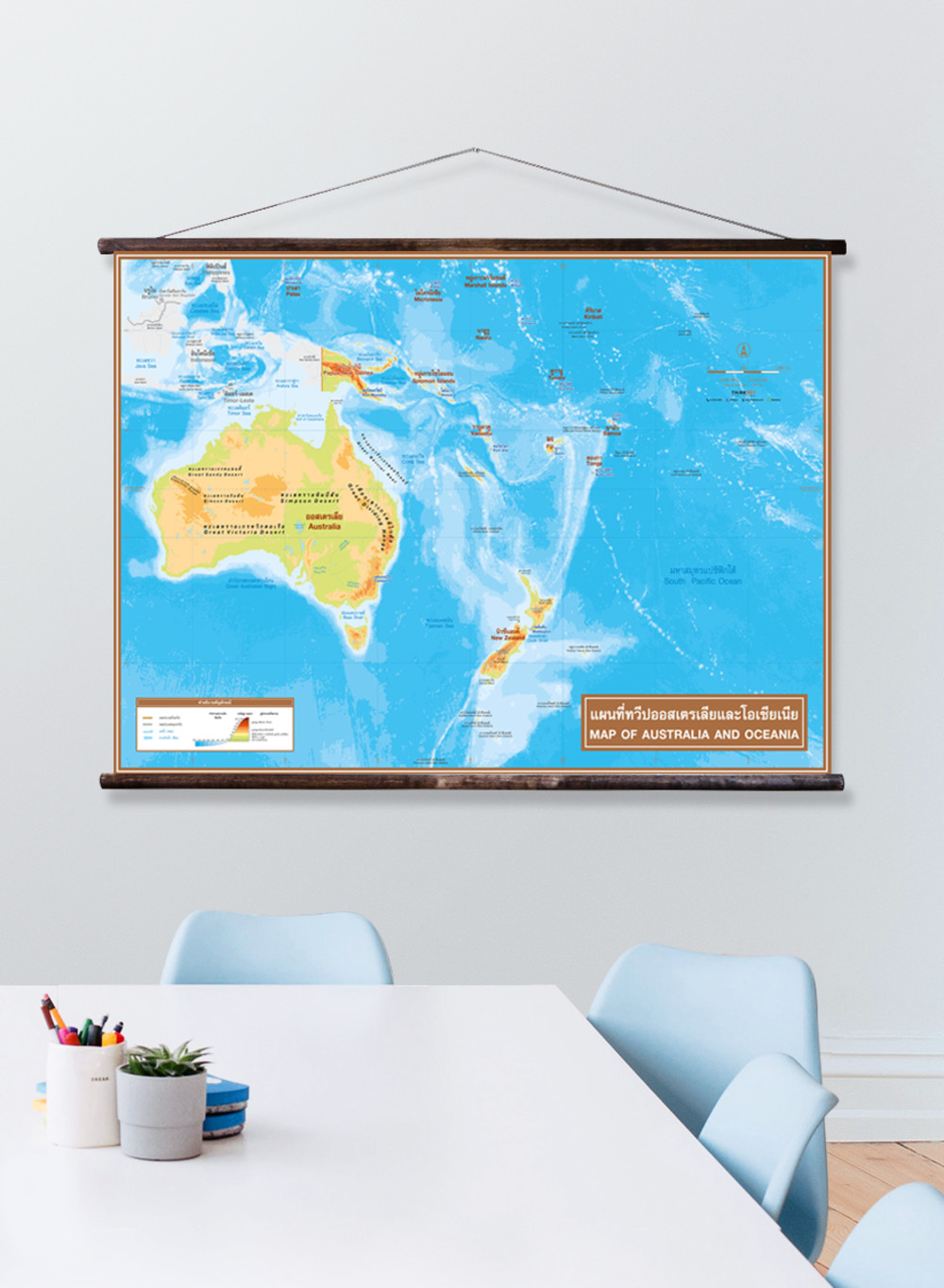
Physical Map of Australia and Oceania
฿449 - 8,999
Media :

Sheet

Roll-up

Frame

Frameless

Board
Quantity :
Product Details
Physical map shows an overview of Australia and Oceania.
• Shows 14 countries in Australia and Oceania: Australia, New Zealand, Palau, Vanuatu, Fiji, Tonga, etc.
• Shows the governmental boundaries of each country and territory borders with neighboring countries.
• Shows capital cities and overseas territories.
• Shows geographic information: mountain ranges, plains, main rivers, straits, lakes, deserts, islands, archipelagos, gulfs, seas, and important oceans.
• Shows geographical features in different colors based on the elevations and depth of the seas.
• Shows the height of the important peaks.
• Bilingual: Thai-English.
• 2023 updated.
• Size (M) 100x69 cm has a scale of 1:12,880,000, size (XL) 138x100 cm has a scale of 1:9,200,000.
• Suitable for junior high school students age 12-14 years old.

฿449 - 8,999

฿449 - 8,999

฿449 - 8,999

฿449 - 8,999

฿449 - 8,999

฿449 - 8,999