อัปเกรด Hard Skills ด้วยภาษาที่ 3 ทักษะมาแรงของยุคนี้
Hard Skills นับเป็นบันไดสำคัญในการเปิดโอกาสไปสู่ความสำเร็จ ซึ่งภาษาที่ 3 ก็เป็นหนึ่งในทักษะมาแรงของยุคที่ควรมีติดตัวเอาไว้
การเดินทางของแผนที่ตั้งแต่อดีตถึงปัจจุบัน
แผนที่ในปัจจุบันมีความเป็นมายาวนาน กว่าจะเป็นแผนที่ที่มีระเบียบแบบแผนที่เรารู้จักกัน ประวัติศาสตร์เบื้องหลังแผนที่ได้เริ่มขึ้นพร้อม ๆ กับก้าวแรกที่มนุษย์ออกเดินทาง
"สีสัน" กับการเสริมสร้างพัฒนาการ
สีมีความสำคัญอย่างไร? THiNKNET Design Studion จะมาเล่าว่าทำไมต้องสอนเรื่อง "สีสัน" ให้กับเด็กตั้งแต่ยังเล็ก
เรื่องน่ารู้ของเรขาคณิต
‘เรขาคณิต’ เรื่องใกล้ตัว ส่วนหนึ่งของชีวิตเราตั้งแต่เล็กจนโต พื้นฐานการเรียนรู้เรื่องภายในชีวิตประจำวัน
สั่งพิมพ์ภาพบนผ้าแคนวาสกรอบลอย พิเศษ! ติดแม่เหล็กได้ เพิ่มนาฬิกาได้
THiNKNET Design Studio บริการพิมพ์ภาพบนผ้าแคนวาสกรอบลอย พิเศษ! ติดแม่เหล็กได้ เพิ่มนาฬิกาได้ มอบให้เป็นของขวัญสุดพิเศษแก่คนที่คุณรัก
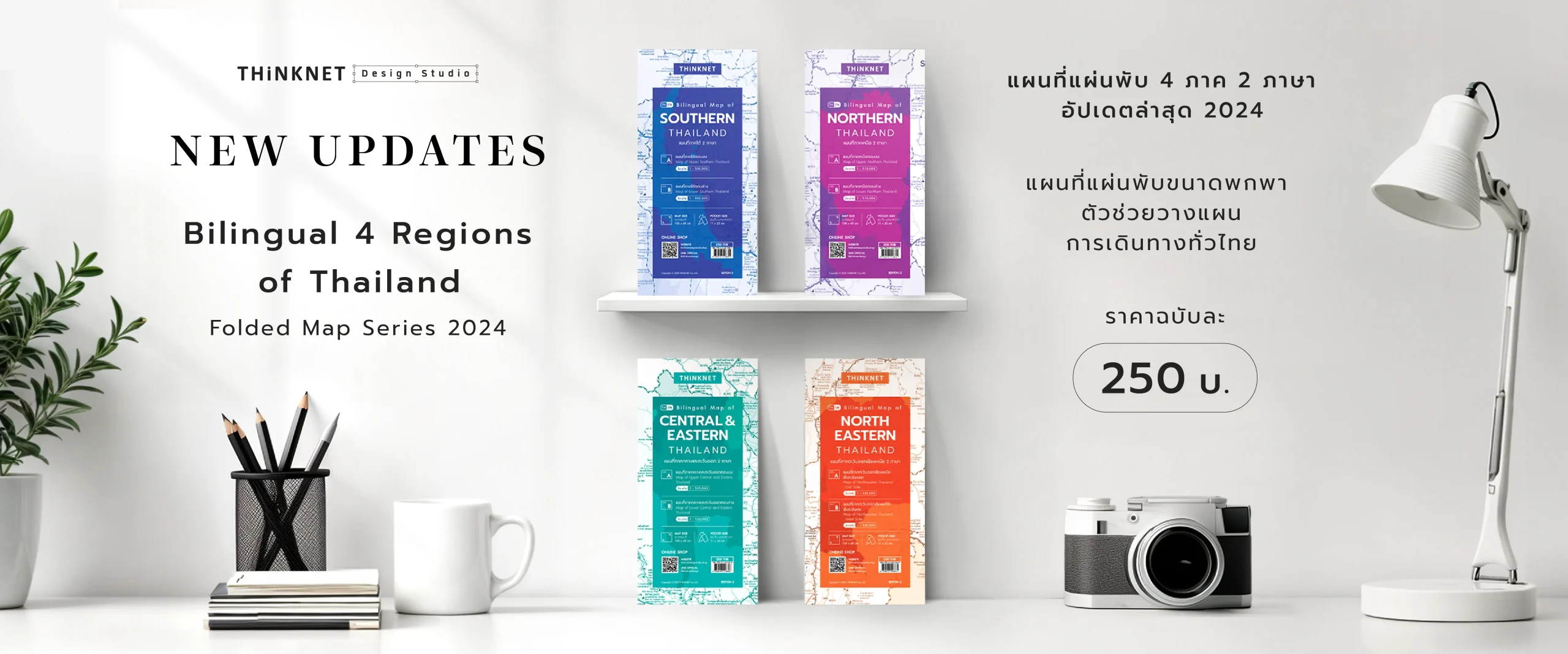
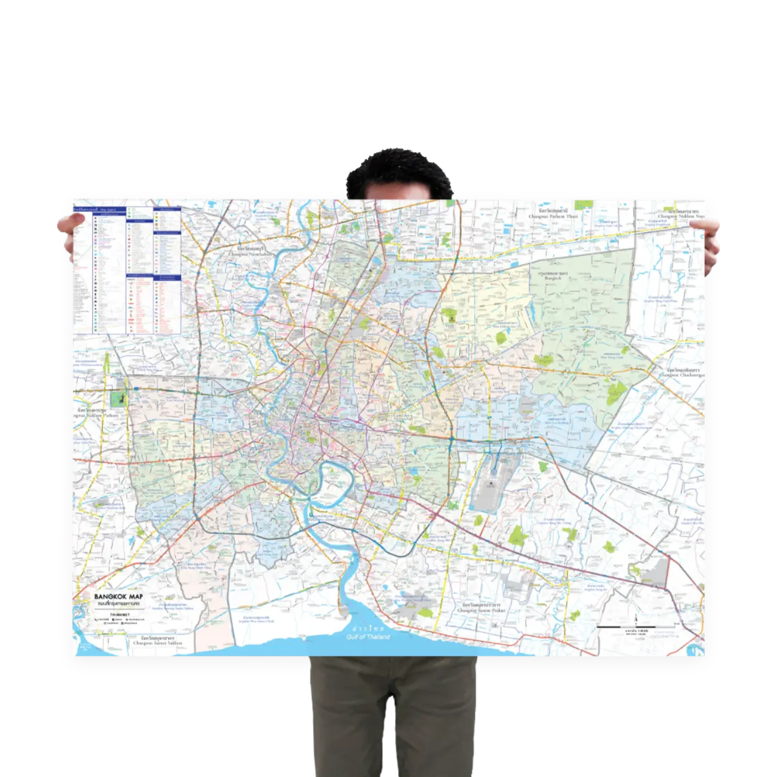
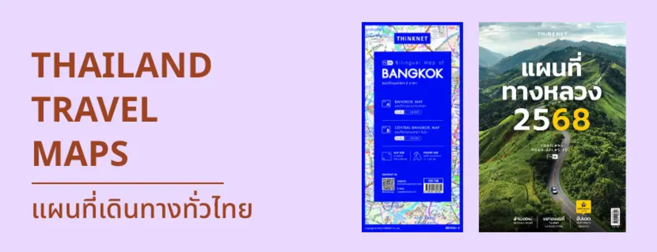
ครอบคลุมถนนหลวงของประเทศไทยอย่างครบถ้วน, เหมาะสำหรับทั้งประชาชนท้องถิ่นและนักท่องเที่ยว, คุ้มค่ากับราคาที่ดี, ข้อมูลล่าสุดเพื่อการนำทางที่แม่นยำ, ข้อมูลล่าสุดเพื่อการนำทางที่แม่นยำ
ใช้ง่ายในการนำทาง, มีประโยชน์ในการวางแผนการเดินทาง, ข้อมูลอัปเดตล่าสุด, แผนที่สะดวกสบายที่ใช้ได้ทั้งภาษาไทยและภาษาอังกฤษ
แพ้คมาดีมากครับ ไม่ยับหรือบุบเลย ขนาดใหญ่ดีจริงๆ5555 เป็นกระดาษเคลือบมันๆ เขียนลบได้ครับ
ได้รับสินค้ารวดเร็วมากๆหลังการสั่งซื้อ ร้านค้าแพคสินค้ามาดี ไม่มีการชำรุด ทดลองใช้งานแล้วโอเคมากๆ ตรงตามความต้องการ
ภาพสวยชัดเจน เป็นสื่อการเรียนรู้ที่ดี
คุณภาพโปสเตอร์คือดีมาก สีชัด คมเข้ม คมชัด ขนาดกำลังพอดี คุณภาพกระดาษโปสเตอร์ก็ดี เหนียว ไม่ขาดง่าย แพ๊คของมาอย่างเรียบร้อย
ประทับใจในทุกสิ่งอย่างคุณภาพของการพิมพ์สีสด คมชัดมาก มีเกาะเล็กเกาะน้อยเกาะต่างๆประทับใจมากๆค่ะ หากใครเป็นสายเนิร์ด อยากมีแผนที่ดีๆ เอาไว้นั่งดูว่าอะไรอยู่ตรงไหนบนโลกใบนี้บ้าง แนะนำร้านนี้เลยค่ะ
สินค้าส่งเร็ว ส่งไว ส่งตรงเวลา ได้รับทันใจ ขอบคุณมาก ๆ ค่ะ ราคาก็โอเค ไว้จะมาอุดหนุนใหม่นะคะ