Bilingual Map of Thailand: Art Paper
฿199฿399
Media :

Sheet
Quantity :
Product Details
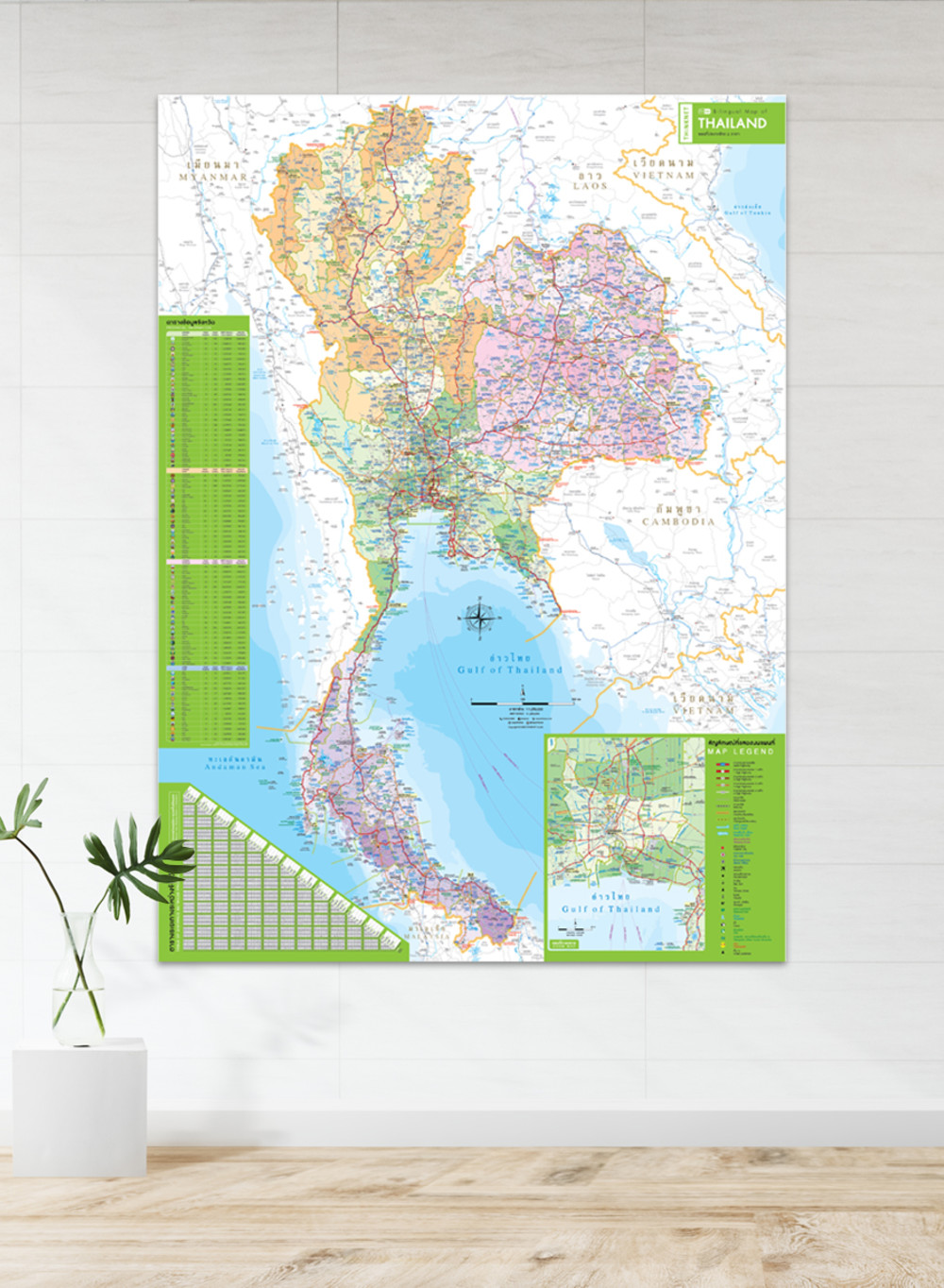
The map shows the administrative divisions of Thailand, regions divided by colors.
• Bilingual information, Thai-English.
• 2020 updated.
• Covers 76 provinces and one special administrative area (Bangkok).
• Shows provincial boundaries, district boundaries, major highways, and borders of neighboring countries including Myanmar, Laos, Vietnam, Cambodia, and Malaysia.
• Shows important spots such as business districts, airports, government offices, city halls, district offices, and tourist attractions.
• Shows index of major highways with distance information, significant spots, etc.
• Shows other interesting spots; railway stations, bus terminals, ports, police stations, hospitals, schools, markets, temples, rivers, canals, waterfalls, reservoirs, dams, etc.
• Offers an additional Bangkok inset map.
• Offers a table of province information.
• Offers a table of distance between each province.
• Provides a legend describing symbols on the maps.
• Latest and upcoming highways updated.
• The map has a scale of 1:1,250,000.
• Detailed map, suitable for trip planning and business management.
• Printed on 160 gsm matte art paper (cannot be written-erased).
• Easy to attach on wall.


