Political Map of China Trilingual
฿449 - 8,999
Media :

Sheet

Roll-up

Frame

Frameless

Board
Quantity :
Product Details
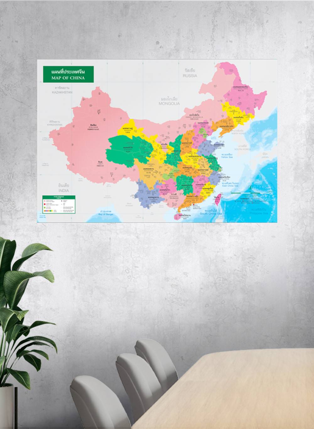
The political map of China shows counties and administrative districts, divided by colors.
• There are 23 counties, 5 autonomous regions, 2 special administrative regions, and 4 municipalities, such as Henan, Shandong, Sichuan, Guangdong, and Jiangsu.
• Distinct county–level and city–level boundaries.
• Shows names, governmental boundaries, and territory borders with neighboring countries such as Mongolia, North Korea, South Korea, Japan, and India.
• Shows capital city and major cities.
• Shows gulfs and seas.
• Trilingual: Thai, English, and Chinese.
• 2021 updated.
• Size (M) 100x69 cm has a scale of 1: 7,500,000, size (XL) 138x100 cm has a scale of 1: 4,950,000.
• Suitable for senior high school students age 15-17 years old.

฿449 - 8,999

฿449 - 6,299฿449 - 8,999

฿449 - 8,999

฿449 - 8,999

฿449 - 8,999

฿449 - 8,999