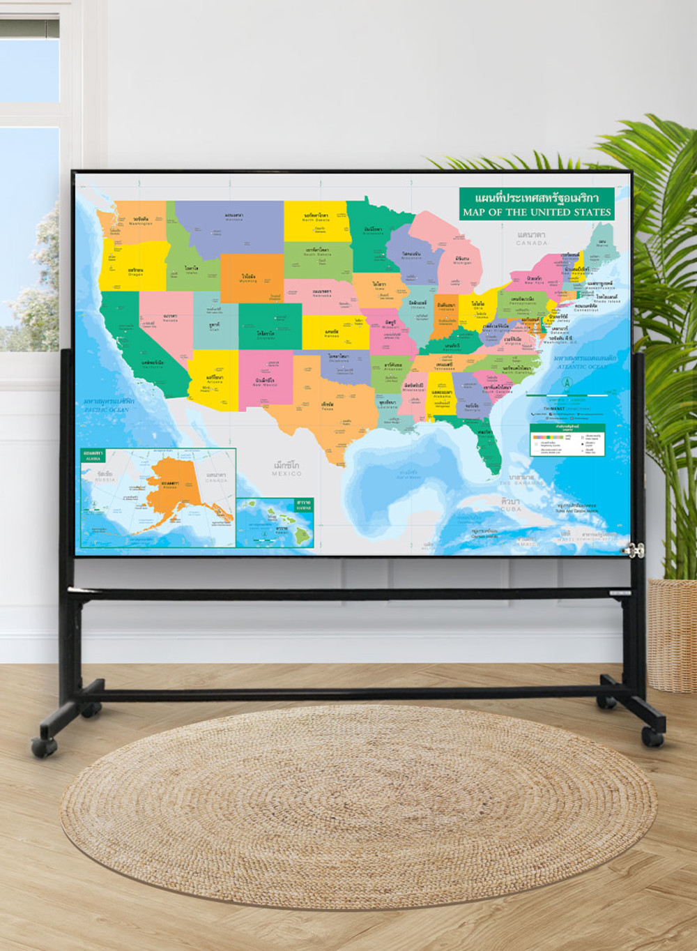
Political Map of the United States
฿449 - 8,999
Media :

Sheet

Roll-up

Frame

Frameless

Board
Quantity :
Product Details
The political map of the United States shows the administrative divisions, states divided by colors.
• Shows the overview of the United States, covering 50 states such as Washington, Oregon, California, Texas, and Florida.
• Shows names, state boundaries, and territory borders with neighboring countries including Canada, Mexico, the Bahamas, Cuba, Jamaica, Haiti, and the Dominican Republic.
• Shows the capital city, state capitals, and major cities.
• Shows oceans, seas, and islands.
• Bilingual: Thai and English.
• 2021 updated.
• Size (M) 100x69 cm has a scale of 1:6,800,000 , size (XL) 138x100 cm has a scale of 1: 4,950,000.
• Suitable for senior high school students age 15-17 years old.

฿449 - 8,999

฿449 - 8,999

฿449 - 8,999

฿449 - 8,999

฿449 - 6,299฿449 - 8,999

฿449 - 8,999