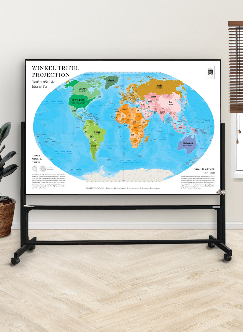
Political World Map: Winkel Tripel Projection
฿449 - 8,999
Media :

Sheet

Roll-up

Frame

Frameless

Board
Quantity :
Product Details
Political world map in the style of Winkel tripel projection is an alternative map to the classic Mercator one. It is based on the azimuthal projection.
• Shows the overview of the world, similar to the Robinson projection. However, this projection has different curved latitude lines instead of straight parallel lines with a low mean scale of area distortion.
• Shows the boundaries divided by colors into 7 continents; Asia, Africa, North America, South America, Europe, Australia, and Antarctica, for a total of 193 countries.
• Shows the governmental boundaries of each country, territory borders with neighboring countries, islands, archipelagos, seas, and important oceans.
• Shows names of countries worldwide, some capital cities, and overseas territories.
• Brief description of the map projection.
• Brief history of the map inventor.
• Language can be chosen: Thai-English or only English.
• 2022 updated.
• Size (M) 100x69 cm has a scale of 1:35,000,000 , size (XL) 138x100 cm has a scale of 1: 25,000,000.
• Suitable for senior high school students age 15-17 years old, or those interested in maps.

฿449 - 8,999

฿449 - 8,999

฿449 - 8,999

฿449 - 8,999

฿449 - 8,999

฿449 - 8,999