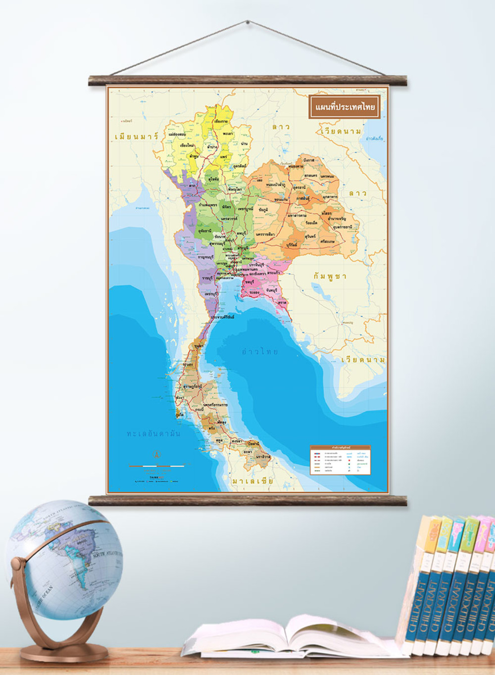
Political Map of Thailand
฿449 - 8,999
Media :

Sheet

Roll-up

Frame

Frameless

Board
Quantity :
Product Details
The political map shows the administrative divisions of Thailand, regions divided by colors.
• Covers 76 provinces and one special administrative area (Bangkok).
• Shows names, provincial boundaries, and borders of neighboring countries including Myanmar, Laos, Cambodia, and Malaysia.
• Shows districts, major highways, and railways.
• Shows rivers, streams, reservoirs, wells, national parks, waterfalls, caves, gulfs, and lakes.
• Can be used for the geographical study of Thailand's province boundaries in each region.
• Language can be chosen: Thai, English, or bilingual Thai-English texts.
• 2023 updated.
• Size (S) 55x80 cm has a scale of 1:2,350,000, Size (M) 69x100 cm has a scale of 1:1,870,000, Size (L) 83x120 cm has a scale of 1:1,560,000, Size (XL) 100x138 cm has a scale of 1:1,350,000.
• Suitable for grade 4-6 primary school students age 9-11 years old.
• Can be used for travel and decoration.
The bilingual Thai-English version shows only provincial boundaries (district is unavailable).
• Size (S) 55x80 cm has a scale of 1:2,200,000
• Size (M) 69x100 cm has a scale of 1:1,750,000
• Size (L) 83x120 cm has a scale of 1:1,460,000
• Size (XL) 100x138 cm has a scale of 1:1,270,000

฿449 - 8,999


฿449 - 8,999

฿449 - 8,999

฿449 - 8,999

฿449 - 8,999