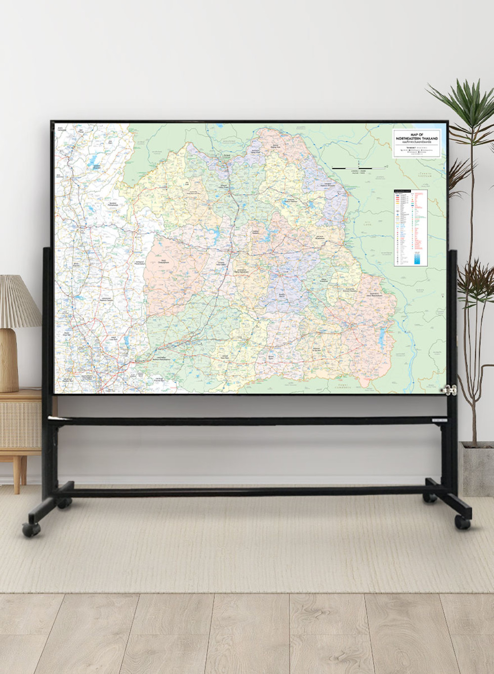
Map of Northeastern Thailand
฿449 - 8,999
Media :

Sheet

Roll-up

Frame

Frameless

Board
Quantity :
Product Details
The map shows the administrative divisions of Northeastern Thailand, provinces divided by colors.
• Bilingual: Thai-English.
• 2024 updated.
• Covers 20 provinces; Kalasin, Khon Kaen, Chaiyaphum, Nakhon Phanom, Nakhon Ratchasima, Bueng Kan, Buri Ram, Maha Sarakham, Mukdahan, Yasothon, Roi Et, Loei, Si Sa Ket, Sakon Nakhon, Surin, Nong Khai, Nong Bua Lam Phu, Amnat Charoen, Udon Thani, and Ubon Ratchathani.
• Shows province boundaries, amphoe (district) boundaries, major highways, main roads, minor roads, soi (alleys), and borders of neighboring countries, including Laos and Cambodia.
• Shows important spots such as business districts, airports, government offices, city halls, district offices, and tourist attractions.
• Shows index of distance information, significant spots, gas stations, EV charging stations, etc.
• Shows spots of railway stations, bus terminals, ports, police stations, hospitals, schools, shopping centers, markets, souvenir shops, wat (temples), rivers, canals, waterfalls, reservoirs, wells, etc.
• Latest and upcoming main roads updated.
• Size (XL) 138x100 cm has a scale of 1:520,000, Size (L) 120x83 cm has a scale of 1:620,000, Size (M) 100x69 cm has a scale of 1:740,000.
• Detailed map, suitable for trip planning and business management.
• Size (XL) 138x100 cm is recommended for better map details.

฿449 - 8,999

฿449 - 8,999


฿449 - 8,999

฿449 - 8,999

฿449 - 8,999