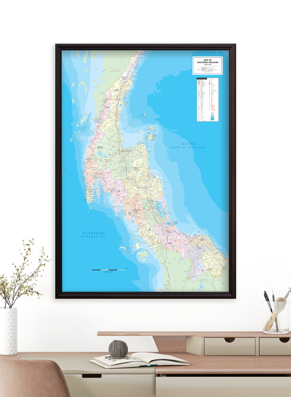
Map of Southern Thailand
฿449 - 8,999
Media :

Sheet

Roll-up

Frame

Frameless

Board
Quantity :
Product Details
The map shows the administrative divisions of Southern Thailand, provinces divided by colors.
• Bilingual: Thai-English.
• 2024 updated.
• Covers 14 provinces; Krabi, Chumphon, Trang, Nakhon Si Thammarat, Narathiwat, Pattani, Phangnga, Phatthalung, Phuket, Yala, Ranong, Song Khla, Satun, and Surat Thani.
• Shows province boundaries, amphoe (district) boundaries, major highways, main roads, minor roads, soi (alleys), and borders of neighboring countries, including Myanmar and Malaysia.
• Shows important spots such as business districts, airports, government offices, city halls, district offices, and tourist attractions.
• Shows index of distance information, significant spots, gas stations, EV charging stations, etc.
• Shows spots of railway stations, bus terminals, ports, police stations, hospitals, schools, shopping centers, markets, souvenir shops, wat (temples), rivers, canals, waterfalls, reservoirs, wells, gulfs, islands, beaches, etc.
• Latest and upcoming main roads updated.
• Size (XL) 100x138 cm has a scale of 1:500,000, Size (L) 83x120 cm has a scale of 1:605,000, Size (M) 69x100 cm has a scale of 1:725,000.
• Detailed map, suitable for trip planning and business management.
• Size (XL) 100x138 cm is recommended for better map details.

฿449 - 8,999

฿449 - 8,999

฿449 - 8,999

฿449 - 8,999

