Thailand Historical Map of Ayutthaya Period
฿449 - 8,999
Media :

Sheet

Roll-up

Frame

Frameless

Board
Quantity :
Product Details
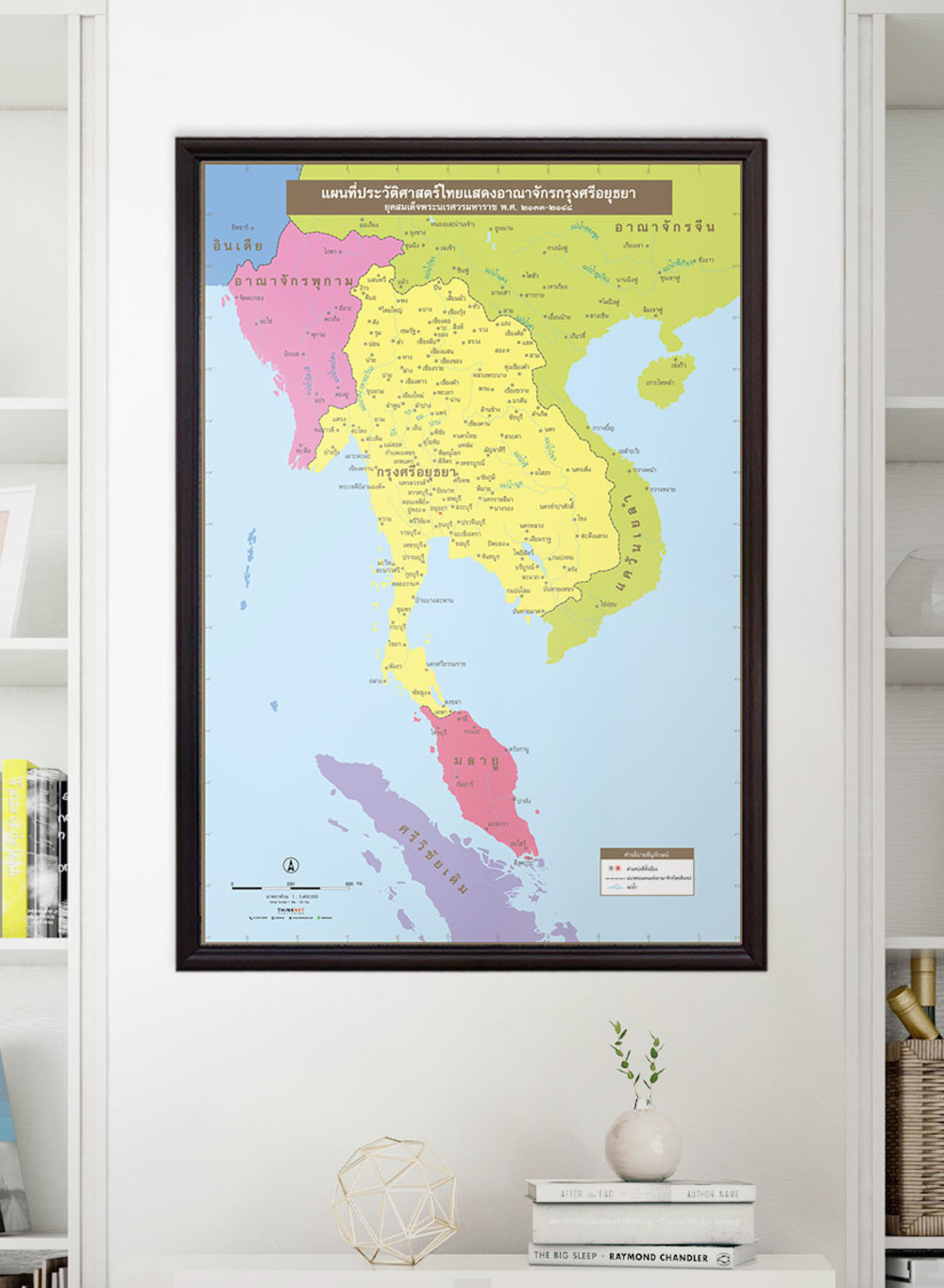
Ayutthaya kingdom map for learning about Thai history.
• Shows the governmental boundaries of the Ayutthaya kingdom in the reign of King Naresuan the Great during 1590-1605. The boundaries are divided by colors.
• Shows the cities in history, current provinces, and locations such as Saen Wee, Siem Mua, Chiang Kho, Phitsanulok, and Ayutthaya.
• Shows brief borders of the kingdom and major rivers.
• Shows territories of neighboring kingdoms in the Ayutthaya period: Pagan, China, and Melayu.
• 2022 updated.
• Size (M) 69x100 cm has a scale of 1:3,400,000, Size (XL) 100x138 cm has a scale of 1:2,400,000.
• Suitable for grade 4-6 primary school students age 9-11 years old.

฿449 - 8,999

฿449 - 8,999

฿449 - 8,999

฿449 - 8,999

฿449 - 8,999

฿449 - 8,999