Political World Map: Orthographic Projection
฿449 - 8,999
Media :

Sheet

Roll-up

Frame

Frameless

Board
Quantity :
Product Details
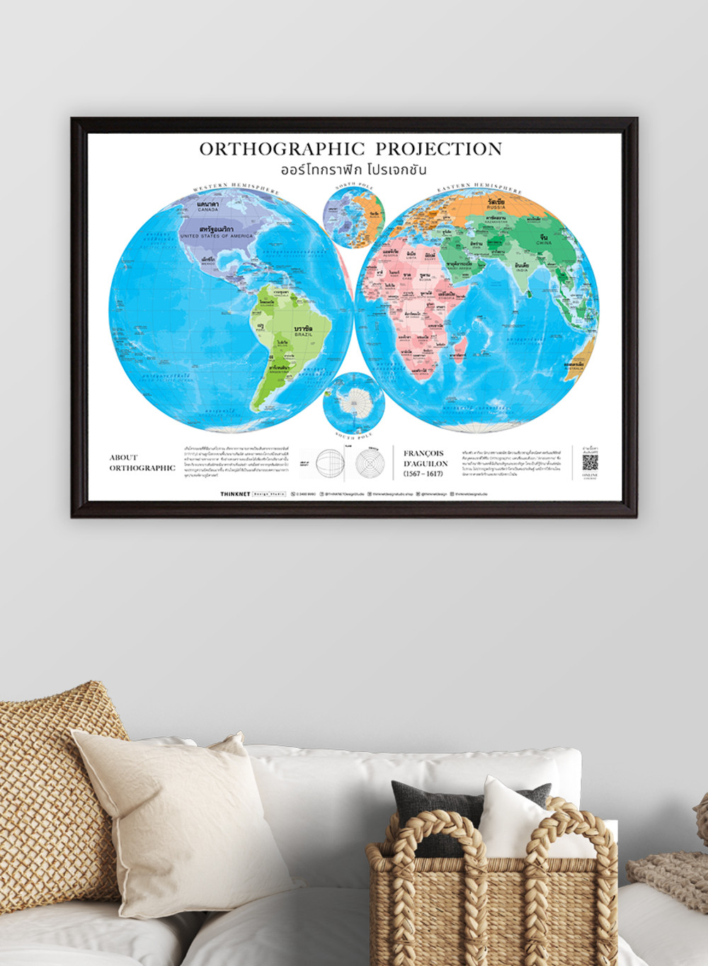
Political world map in the style of an orthographic projection is an alternative map to the classic Mercator one. This map has been around since ancient times and is usually used as an accompanying map for an article rather than for a geographical purpose.
• Shows the world in a three-dimensional perspective, similar to aerial photographs. It visualizes the details of each hemisphere where the tangent plane has an accurate scale. However, the more it is far away from the tangent plane, the more distortions appear.
• Shows the boundaries divided by colors into 7 continents; Asia, Africa, North America, South America, Europe, Australia, and Antarctica, for a total of 193 countries.
• Shows the governmental boundaries of each country, territory borders with neighboring countries, islands, archipelagos, seas, and important oceans.
• Shows names of countries worldwide, some capital cities, and overseas territories.
• Brief description of the map projection.
• Brief history of the map inventor.
• Language can be chosen: Thai-English or only English.
• 2022 updated.
• Suitable for senior high school students age 15-17 years old, or those interested in maps.

฿449 - 8,999

฿449 - 8,999

฿449 - 8,999

฿449 - 8,999

฿449 - 8,999

฿449 - 8,999